Where are we?


View Parents Location in a larger map

Thursday, November 29, 2007

Saint Augustine


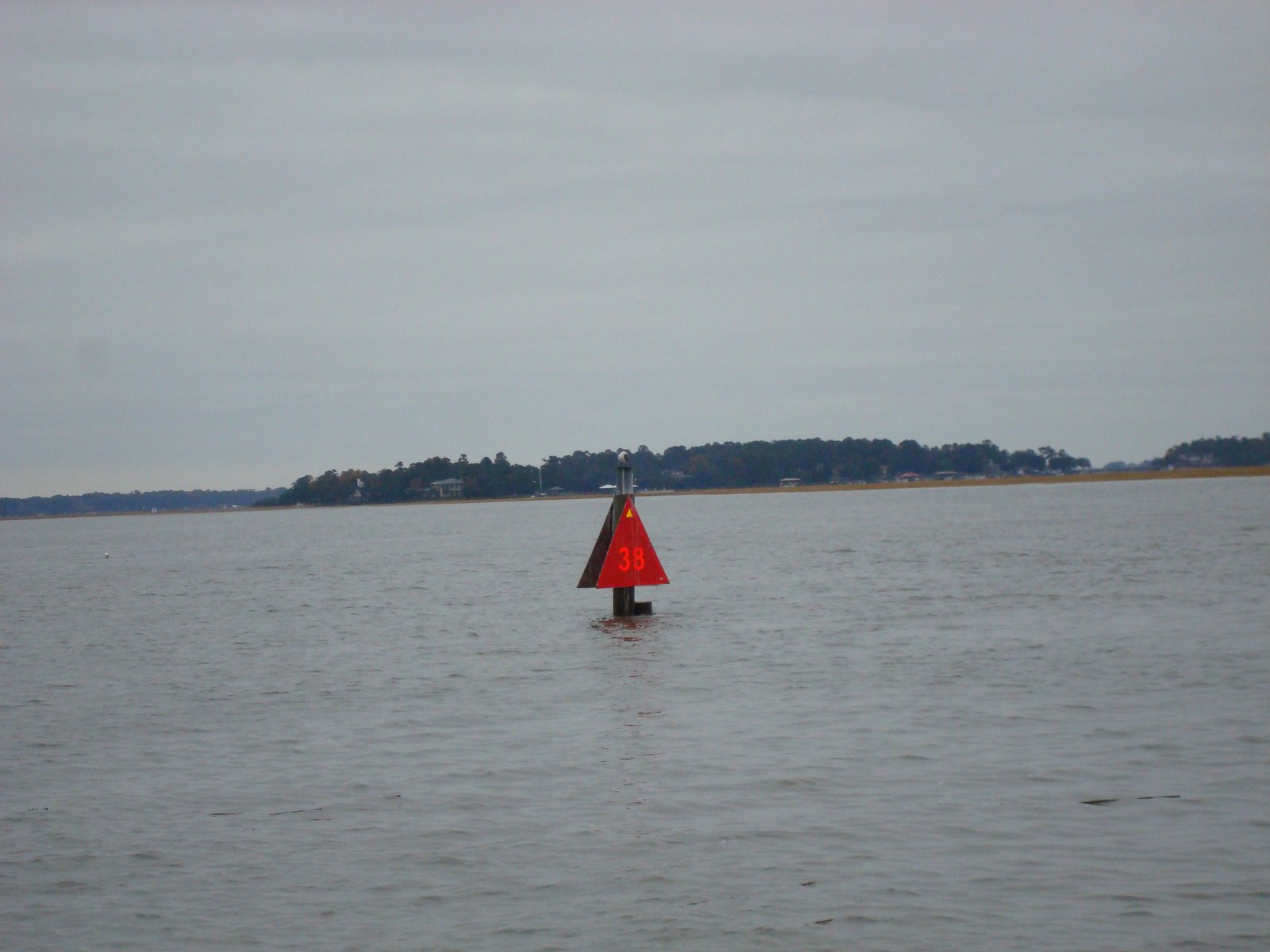
Gray day but enjoyed viewing some more marshes and woods . All sorts of birds in big flocks. We saw many hawks and osprey as well as a bald eagle! Raining but we saw a fabulous rainbow as the day cleared a bit. Picked up a nice push from the tide and made almost 70 miles into St Augustine. Many miles of straight canal sailing are interspersed with a few sounds and inlets presenting some navigational challenges. Often we would follow a few sets of sea buoys when crossing sounds. When using the sea buoys we are most often leaving the harbor so the green marks are on the right but when we would reenter a river or landcut, the red markers needed to be on the right. Sometimes there are nuns and cans, sometimes there are daymarks. Sometimes the daymarks on stakes mark private channels. The ICW marks always have yellow reflective triangles and squares on them and they do clarify things but I think I need the large print edition. As we were entering St Augustine the charts said that nuns 58,58A, 58C, 58D and 58E would mark the channel entry. (I don't know why no B it just didn't show up on the chart) We saw 58 and 58 A , then we saw 60 . No problem things change. When we saw a nun marked 0 it was hard to take seriously. 0? Not on the chart so we started to cut it and watched the depth sounder go from 30 feet to 6 in short order . We honored the marker to get back into deep water. Passed under the Bridge of Lions and into St Augustine. This once beautiful bridge is under construction until 2010. It is covered with elaborate scaffolding and tugs ,barges and workers. I hope it turns out to be as impressive as it was. We are happy to be here and will go out to celebrate our anniversary. 32 years! If we can manage this live aboard stuff I think the marriage just might last!

FLORIDA


Dropped the hook just over the Florida border about 3 miles past Fernandina Beach. Lots of powering through these waters. Tom was listening to the radio when someone came on saying " I am the southbound trawler on your stern. I 'd like to pass you to your port side. " The sailboat he wanted to pass replied that "in these waters we are all trawlers . Some of us just have sticks. " The way has been so narrow and winding, with so much shoaling that we haven't had the sail up in days . Fernandina Beach is a great place ashore, fun and friendly. But as you first sail over the border all that comes into view are industrial works and barges. It is not what comes to mind when we think Florida. The tides here are still pretty big and we nearly ran aground following a tug and barge down the channel at low tide. I blithely thought that if he could go there so could we. I guess a tug has enough power to make his own channel! As night began to fall we were in the Amelia river. This was a pretty anchorage with good holding but very narrow. We were too close to shore to put out enough anchor line. When the tide and wind came up before we went to bed, Tom had to put out a lot more scope. Then he needed to reel all that line in at about 3 AM so we wouldn't end up on the shore at low tide. We opted to leave that anchorage early before we had to go through the drill again!


Fort Fredrica was our last stop in Georgia. We were both impressed with the marshes here. The development is not overwhelming and the marshes feel wild. The waterfowl are abundant. In the Herb river we saw several wood storks as well as ibises and herons of all sorts. We especially liked the fact the one of the rivers was named Herb River and we took the opportunity to toast the Willis clan. Tom greatly enjoyed my singing as we passed the Moon River of Andy Williams fame. I am very surprised he hasn't asked me for a repeat performance. The intracostal continues to meander through rivers and creeks, man made canals and big sounds with ocean inlets. Quite impressive. On the larger waters we often saw shrimp boats. I remember being quite enamored by these since they will often sell shrimp at wonderfully low prices. However, when they have lines out, they are working and they are serious about work. If your mast was in the way of their arms I am not too sure the arms would come up! They have very limited maneuverability with their nets are out and we gave them a wide berth. Georgia also has remarkable tides. They generally run about 9 feet and since it was a moon tide they were even higher. these tides give a great boost and with them we travel at almost 8 knots. the reverse for reasons which seem a mystery(to me) but probably have to do with what inlet is closest. When running against them we were lucky to see anything more than 4 knots. We looked and looked for wild horses on Cumberland island but I think that you really need a hike to see them and as much as we liked Georgia we are still pushing to get south.

Fog

Monday morning found us at anchor in the Wahoo River, Georgia. We awakened with 7 or eight other boats to a cool but clear morning. NOAA predicted a southerly wind and inland fog until 9am. We got off around 8, not first, but not last, and proceeded out the river to the sound. Seems like it must have been slack tide, because we made the first few marks with no problems. Rounding the seaward mark, and heading back in the tide must have changed, because there was the thickest fog this side of Kennebunkport! Susan plotted each upcoming marker, now about a quarter mile distant, and we slowly advanced. Moving on the assumption that the fog would be over at 9AM as predicted, we followed the Magenta line into rivers, creeks, and canals at a snail's pace. At each mark we would stumble upon other cruisers in a similar situation. Eventually we fell in with one brave soul who must have had major electronics, and obtained a tail. With the three of us on the radio the whole time, we became friendly and chatty. Even three days later, we are still talking about this when we meet. The fog lifted once and we three found we were six. Then it closed in again. Passing through another sound to a river, the wind started to blow the fog away, and we six became eight. At this point we were passed by a number of patient power vessels, and some not so patient. The banter on the radio was interesting. By the end of the day, we had lost too much time to make Jekyll Island, so we anchored next to Fort Frederica, the original settlement of Georgia's first colonists, which were Irish prisoners!

Friday, November 23, 2007

Tom's Creek to Beaufort SC

In SC they call it BEW - fort as opposed to BO - fort in NC. A cold front has been blowing all day high winds and a winding path. We probably travel 10 miles over the ground to get 2 or 3 as the crow flies. The tides are huge here - 7 or 8 feet and today on the full moon they expect as much as a 10 foot tide! Definitely need to watch the channel markers. On the charts the Intracostal Waterway is marked in a purple color Perhaps the chart makers work with crayola as it is called the magenta line. When there are shoals or big tides the cruising guides admonish us to "stay exactly on the magenta line as charted" and we are trying to . Pretty through these marshes and many shore birds wading along exposed oyster beds. Dolphins are playing almost everywhere!

Thanksgiving in the Marsh


Left Charleston with high winds, cool temps and grey skies. Weather forcast was for rain and cold. We would be reluctant to leave charleston no matter the weather but this was not inviting. By early afternoon the sun was out and it was getting warmer. We anchored in tom's Point creek to cook Thanksgiving dinner. Silver candlesticks and plastic wineglasses but so many things to be thankful for. This marsh was again on a creek that was about 70 feet wide and 20 feet deep. The rivers are not all the big! Nice well protected anchorage.


Wednesday, November 21, 2007

Charleston


Easy sail over to Charleston after a picturesque morning. The barrier islands and palmettos give way to a busy harbor. It is amazing to see Fort Sumter at the entrance to the harbor . Great city and we are having fun in between provisioning and changing oil and filters etc. Weather is just spectacular! It is 78 and beautifully sunny! We will roast a little turkey tomorrow and some cranberry something just to be in the festive spirit. One thing we are so thankful for is that new oven. Doesn't feel like Thanksgiving without family and friends and we miss everyone. Our internet connection is weak and can't seem to manage pictures but we'll add a few later. We will toast you tomorrow!

Georgetown to Charleston - almost


Leaving Georgetown we had a bit more cruising through landcuts then on into the marshes that run along beside the barrier islands on the way to Charleston. Pretty straight forward and well marked. The tide was with us and we started to think we would make it to Charleston before dark. One little problem was that the swingbridge across the Intracostal closed from 4-6pm and it looked like we would arrive at the bridge around 420pm. Clearance for the bridge whne closed is 20 feet but the mast is 55 ft high so..... we would need to wait. By six it is pitch dark and we weren't interested in crossing the channel into this harbor without at least some daylight. Once we came to terms with yet another instance of time and tide waiting for no one, we decided to anchor in Dewee's creek not quite 10 miles out of Charleston. We turned off the ICW and 12 feet of water into the first unnamed creek off Dewees creek --and into 29 feet of water . I better look up the definition of creek! It was fairly early and the weather was really nice so I went kayaking. What a beautiful spot and what a gift that we couldn't make the bridge. Every imaginable bird was there, herons, pelicans,egrets. There were about 10 oystercatchers . Dolphins were fishing not 6 feet away, we could hear them breathing as they surfaced. The sunset was spectacular and turned the water pink and violet before it finally got dark. I am so glad we missed the bridge!

Tuesday, November 20, 2007

Barefoot Landing to Georgetown


Supposedly there are 120 golf courses in the North Myrtle beach and Myrtle Beach area. We saw many people golfing along the ICW . Indeed this seems to be the only wildlife for a while. One course runs a gondola over the waterway. I thought for sure our mast would take them out but no sweat. The trick here appears to be stay afloat. For several miles the rockpile continues. Coquina stone riprap crowding the edges of the channel and a rocky bottom. It is a narrow channel too. Little by little this goes from a narrow threatening waterway to one with less development and erosion. There are more trees and they are hung with spanish moss. There is however, a great deal of work for dredges. In one place, the channel marker was about 10 feet out of the water! The cruising guides keep giving lat and long for shoal areas but I think it might be easier to say where there are no shoals. Development continued to fade away as we entered the Waccamaw River. It's broad and happily very deep. It feels as though you could touch the edges when the depth sounder says 26 feet of water. Deep forests appear behind greengold marshes. Many tree stumps and everything is hung with spanish moss. Beautful in a spooky sort of way, very scenic and peaceful. After a sunny and believe it or not WARM afternoon the Waccamaw river joined the Great Peedee river outside Georgetown. Anchored off the town center and totally switched directions 1/2 hour later when the tide changed. You could watch all skippers adjusting lines as if on cue. Anchor held fine and we slept through the next tide change.


Sunday, November 18, 2007

South Carolina!


Left Southportand joined a parade of other vessels. The way remains quite straight and positively bristles with docks. Many seabirds the herons stand on dockposts like cormorants. Odd but still pretty. They are spectacular as they fly over the marshes. Pelicans everywhere and Turkey vultures circling and riding the air currents. This was a slow ride. narrow channel, lots of shoaling and the first bridge only opens on the hour. this bridge is a pontoon bridge. The road actually floats on pontoons and the bridge operator uses an underwater cable to float the bridge over to the side to let people by.
After that straight down the ditch with a couple more bridges. We pulled over literally at a place called barefoot landing. Almost dark and no where else to go. The name sounds great but Barefoot landing is a few highrises and a gigantic shopping mall, really hundreds of stores. If you can resist them the ocean beach is just about a mile away. It looks like Miami Beach! Really high rises probably 30 floors or more. Busy place !We will be on our way tomorrow hope to get to Charleston early in the week. If we don't get internet access before Thursday Happy Thanksgiving to all!

Topsail Island to Cape Fear

Day broke with ice on the docks and a gentle breeze. The cruising here is all about staying in the channel and away from the shoals, otherwise mostly a long straight path past barrier islands in between the big barrier beach and the mainland. When we passed here 6 years ago there were many windswept piney stretches of sand. You really could picture pirates at the inlets. Now houses and houses and highrises and houses. It seems to me to have changed on a really big scale. Still as you go on there are small, pretty marshes and many seabirds . As you pass the inlets the water is a beautiful color blue , diluted as you stay more in the intracostal. At Carolina beach - which looked spectacular from the glimpse we had of it - we turned and followed a narrow cut into the Cape Fear River. Here , since we were entering the river, the buoys reverse and green goes to the right. Gave us something to think about, I am glad to say we had figured that one out before we got there. The tide picked us up and we traveled the river at about eight knots ! I would love to say we planned that but sometimes it is just good to be lucky. Left the Cape Fear River dodging commercial traffic and ferries, and turned into the small basin at Southport. The anchorage is really small and it was crowded so we pulled into the dock at a small restaurant. Free with a meal is the rumor. Restaurant closed but dockspace available so we stayed. this space is just a little close to the ICW. As each boat goes by the wakes rock and roll and rock and roll. Tom pulled off a 4 am lines drill after we were awakened by several bizarre noises along with the wave action. Only needed to reset fenders,I offered strong support from the warmth of the covers in our bunk. He was a popsicle as he came back to bed.

Saturday, November 17, 2007

to Harbor Village Marina

Dawn came with 20kt winds, with higher predictions as a cold front was to pass that night. We felt a safe haven might be better than staying at anchor in the swamp, so at 0800, we left. Again, we clawed our way upwind under power, struggling against the gusts of wind that aimed to blow us out of the channel. We felt pretty alone, as most of the Mile Hammock anchorees stayed put, and the waterway seemed deserted, except for the passing dolphins. A few times we experienced light showers, which moderated the gusts, but mostly it seemed like an uphill battle. Finally, we were fully dressed in foul weather gear, the clouds were darkening, and the wind was increasing. We stopped at a newer marina just before approaching Figure Eight Island Swing Bridge. This bridge will not open if the wind is over 30 MPH, and we were experiencing 25kts, so we did not know how much further we could go anyway. Ducking in shortly afternoon, it seemed like the coward's way out, but by 2PM the front passed through. The heavens opened, the wind howled, and the temperatures dropped. Even in the slip, we were tossed about.

ditch running:Beaufort to Mile Hammock

This portion of the intracoastal waterway is fairly rural, and on a windy day can be challenging. So, up for a challenge, we shoved off from Beaufort a little early to make the run into the wilds of US Marine training Camp LeJune. Basically the course is a straight line, and one navigates by depth sounder, not chart plotter. At each opening to the ocean, the boat is blown inshore, and one must compensate at the helm. All was going along fine, until TowboatUS passed us, enroute to a rescue. Way up ahead we watched as a big wooden ketch, INDIA, was towed off a shoal, and she was free by the time we got close enough to see the area. Believing the markers and charts, we started over this path, and promptly ran BRILLIANT hard aground. "Well", said Susan,"Henry Plummer always said 'go off as you came on'...so we hit reverse and promptly backed off into deeper water. Then, with the help of a little local knowledge (the towboat operator) we finally found the deep water and proceeded into Marine Country. Now, this day at Camp Swampy was helicopter training day. There were the big "egg beater"troop transports, attack types, Vietnam era types, the new movable wing combination types, all out for a windy afternoon ride over the boats anchored in their training pond. Anchor down by sunset, holding well into the night, as we turned in for a needed rest.

Wednesday, November 14, 2007

Leaving Beaufort

Beaufort has so many things to recommend to it. It would be a great place to spend weeks. Lots of places to kayak hike etc. Waterfront dominated by docks on one side and wild islands and barrier beaches near the inlet. Commercial at Moorhead city just across the way. We are pushing south after a great stop. Will probably not have access for a while . Tonight we should be at a small bay near Camp Le Jeune. If the Marines are firing across the ICW we will have to wait an hour or so. I will not mind. Better than dodging bullets!!!!! The way now is inside barrier beaches, I think is is beautiful. Story goes that many pirate ships waited until they could see topsails here and then used the inlets to go capture their prey ! There have been Dolphins playing around the boat. We must be getting south!

On the way to Beaufort

After Norfolk and the bridges the way becomes more varied. Swamps like this but many open bays too.


We took the Virginia cut. After Norfolk the commercial presence continues for miles. The the water way becomes varied and wild. dismal swamp route was closed due to low water levels. We had planned on Virginia cut anyway. The one lock scarcely seemed necessary as we lowered only a foot. We motor sailed many times but not too much sailing too narrow in some places and too twisty in others.

Getting to Beaufort NC Virginia


As I write this from Beaufort, I am thinking how many great places there are to explore, but we still want to keep heading south. Virginia has big big rivers with great ports and coves . Lots of surprisingly big vessels and freighter traffic. But we just sailed across . The cold weather and very short days are powerful motivators. We had only 3 stops in Va, Reedville off the Great Wicomico River, Deltaville off the Rappahannock and Norfolk ,a huge port. Reedville is a fishing port with a processing plant. In theory, proceeding up the river brings you to a quiet town. As we entered the river is was almost dark. The entry is loaded with these pens, called fish traps or havens and crab pots. Almost as many as there are lobster pots in Maine. Although the setting sun made it difficult to see obstacles it looked almost as though it was creating a path for us. We dropped a hook just inside the creek almost opposite the fishing dock. Poor judgement. Really big fishing boats apparently need to leave at staggered times. They go out all night and return all early am. So we are snugged under the covers since again it's cold and first we hear big diesels then feel the roll of the wake. It should have been restful but I didn't feel the lullaby. I was being ricked awake. Anchor held though and we got an early start on the day. note to self proceed up the river. Next Day lived up to its small craft advisory conditions. Really strong winds and 3-4 foot seas. Ran down to Deltaville until the wind came around on our nose. We entered from the Bay although the marinas etc. are mostly off the river. Delta ville has entrances on n both Chesapeake and the Rappahanock. TLong entry almost 6 miles but sheltered and nice anchorage, fuel and a walk etc. Very rural once you are away from marinas. Next day long push to Norfolk. Tom found a channel away from shipping lanes. I didn't see it on GPS and thought he would run us aground any minute. Nevertheless he got us over all kinds of charted shoals - boldly going where boats have run aground before, in a cold strong wind. Ran into Norfolk and down the Elizabeth River with freighters tugs and barges. They are really big. Norfolk is so busy. In addition to all the commercial traffic there is a huge navy presence. We watched a helicopter and a couple of boats maneuver tows. the helicopter was towing! Strange to see the tow line coming from the sky to the water! Norfolk begins the Intracostal proper. We have been over 700 miles to get to the beginning!

Getting

Tuesday, November 13, 2007

Getting to Beaufort NC - Down the Chesapeake


Sailed past Annapolis hoping to put ourselves a little further south. Many, many sailing races underway. Seems like hundreds of boats. Tom had to weave his way between racing boats, channel marks, freighters and other sailors just enjoying the day. Good thing he likes a challenge! Wind variable but picked up in the afternoon. Colder and colder as day continued. We put into the Rhode River and threw out the anchor in a beautiful cove behind high island. High island is not high at all. The foliage is fading but there are still many yellows and reds along with some bare trees. We had turned the clocks back and boy did it get dark early! Set out for Solomons the next am . It was quite literally freezing and the kayak was frost covered. Cold but mostly sunny. Wind picked up as the day went on . Close to 20Knots on the bay when we got in but the harbor is protected and the wind didn't seem too wild once inside. Solomons is fun -again off season and not crowded. The predicted front came screaming through about 5 am poured and howled until about 10: 00 am . We shoved off after front with a cold breeze on the nose. Still wearing full regalia these days, long underwear, turtleneck, sweater, fleece and fleece vest, with a jacket for topper. Hats and gloves required. God help us if we fall over. Sailed past a couple of those great screwpile lights typical of the Chesapeake. Tacked our way across the wide Potomac River and we were into VA. We felt a little sad to leave so much of the Bay unvisited but the wind was cold and strong and south is calling us!


Getting to Beaufort NC -Chesapeake City to Baltimore


We have made it to Beaufort NC!!! Apparently I was a little optimistic about the availability of WiFi . I thought that I would have updated things earlier but never mind. We have been in and out of bays, rivers, sounds, narrow land cuts and creeks. When we left Chesapeake City we sailed to Baltimore. Spent almost a week with Brendan and the southern clan members Herb and Lois Willis. The boat was at Hanover street marina, snug and secure while Noel blew through outside. Many projects and many fun times. We tried to repair our broken oven , but despite the best minds in the area -Tom, Herb and Brendan- working on this project, we were not completely successful. We were able to get flames all over the stove (literally)just not in the oven. As I reached for the fire extinguisher, we decided on a new stove. It was an excellent project- from finding one the appropriate size to finish work and gimbaling . Surprisingly little swearing. Stove heats cabin well whenever we bake and good thing because it has been really cold. Sailed out of Baltimore in nice winds and sun . Busy port we felt very insignificant next all the tankers , tugs and tows.

Friday, November 9, 2007

Delaware Bay

Delaware Bay, famed for foul chop and strong tides is always cause for careful planning. Our run up Delaware bay was during a really narrow weather window. We wanted to access Delaware Bay through the Cape May Canal. Cape May Canal are two bridges with 55 foot clearance. Brilliant's mast is 55 feet high. It was also a full moon so all the more reason not to try this at moon high tide! The tide in Delaware Bay runs about 2.6 knots -stronger during a full moon so we wanted to get that right too. The tide was in our favor starting at 200 AM. Sunrise was at 7:04AM. We decided half tide would do it and set out at O - dark hundred. It was really dark and raining but we had fishermen for company. Dawn came as we exited the Cape May canal into Delaware Bay. The wind was blowing 17 knots with frequent gusts but it was at our backs and rain wasn't cold. The wind and tide with us we were making about 7 and a half knots! Several times the GPS said 9 or a little more. Once a huge freighter disappeared into the fog and rain. It was only about 2 miles away. Happier when we can keep an eye on those guys. Kept a fair tide through steep chop, blinding rain and really strong winds all the way to C and D Canal. Happily threw out a hook 13 miles later in Chesapeake City. Dark and Stormys to celebrate a wild, exciting, surprisingly fast run up the Bay! I think that was more almost 70 miles in about 8 hours!!!!!!!!!!

Saturday, November 3, 2007

New York and New Jersey


We've been making progress. Port Jeff to Oyster Bay and the next day on through New York City(always exciting and inspiring) and on to Sandy Hook NJ. Spent a rolly night in Sandy Hook off the Coast Guard Base. It is a pretty spot but weather and /or many ferry wakes make for a lively night. New Jersey took several days. We had a great time seeing my mother and sister Joanne at Island Heights Tom's River. wild weather and gales holding us in Cape May for several days. In spite of the impatience I was feeling, I was again surprised at how lovely New Jersey is.